Dettagli
Anno di pubblicazione
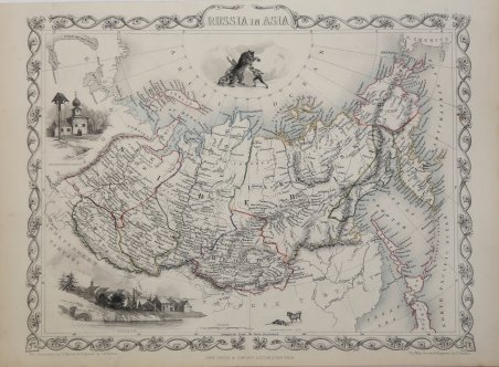
1851
Descrizione
Decorativa carta geografica pubblicata in The Illustrated Atlas, And Modern History Of The World Geographical, Political, Commercial & Statistical… edito da John Tallis. Le mappe del The Illustrated Atlas ' non solo fornivano conoscenze geografiche aggiornate, ma utilizzavano anche viste a vignetta all'interno del disegno per mostrare i popoli nativi e le loro occupazioni, le città e i punti di interesse. Le mappe si rifanno alla tradizione cartografica dei cartografi olandesi del XVII secolo, con bordi decorativi finemente incisi. Le tavole sono state disegnate e incise da John Rapkin con vedute realizzate da una serie di artisti di spicco. Le mappe furono pubblicate in volume completo dal 1851 fino al 1865 circa. Alcune delle mappe furono pubblicate anche in altri libri di storia pubblicati da Tallis, tra cui quello sulle British Colonies e, senza le vignette, in dizionari geografici ed enciclopedie fino al 1880 circa. John Tallis (1817-1876) era un editore di mappe britannico. Nato nelle Midlands, Tallis arrivò a Londra negli anni '40 del XIX secolo. Tallis iniziò la sua carriera londinese con una serie di notevoli vedute stradali di Londra. Iniziò una collaborazione con un certo Frederick Tallis, forse suo fratello, ma la loro collaborazione terminò nel 1849. In occasione della Grande Esposizione del 1851, Tallis pubblicò il The Illustrated Atlas. Le mappe furono successivamente ristampate dalla London Printing & Publishing Company, che lasciò intatta l'imprint di Tallis, assicurandogli così una fama duratura. Incisione su acciaio, coloritura dei confini all'acquarello, in ottime condizioni. Decorative map taken from The Illustrated Atlas, And Modern History Of The World Geographical, Political, Commercial & Statistical by John Tallis The maps from ' The Illustrated Atlas ' were first published in serial form to a target audience that led insular lives due to the expense and hardship of travel. All that changed as the progress of the nineteenth century brought swift and dramatic changes in public awareness of far away places. Tallis' maps no doubt played an important role in this dramatic awakening. These maps not only provided up-to-date geographical knowledge, but also used vignette views within the map's design to show the native people and their occupations, cities and points of interest. The maps hark back to a cartographic tradition from the Dutch mapmakers of the seventeenth century with finely engraved decorative borders. The maps were drawn and engraved by John Rapkin with views drawn and engraved by a number of prominent artists. The maps were issued as a complete volume from 1851 until about 1865. Some of the maps were also published in other history books published by Tallis including ' British Colonies ' and, without the vignettes, in geographical dictionaries and encyclopedias until about 1880. John Tallis (1817-1876) was a British map publisher. Born in the Midlands, Tallis came to London in the 1840s. Tallis began his London career with a series of remarkable London street views. He began a partnership with a Frederick Tallis, possibly his brother, but their collaboration ended in 1849. For the Great Exhibition of 1851, Tallis published the ' Illustrated World Atlas, ' one of the last series of decorative world maps ever produced. The maps were later reissued by the London Printing & Publishing Company, who left the Tallis imprint intact, thus ensuring his enduring fame. In 1858, he began publication of the popular ' Illustrated News of the World and National Portrait Gallery of Eminent Personages, selling it in 1861 (it ceased publication in 1863). Cfr.


 Scopri come utilizzare
 Scopri come utilizzare