Eastern Archipelago - Arafura Sea, Eastern part of Banda Sea and the Northwestern portion of New Guinea
Eastern Archipelago - Arafura Sea, Eastern part of Banda Sea and the Northwestern portion of New Guinea | Stampe | Admiralty Charts
Stampe
Admiralty Charts
Eastern Archipelago - Arafura Sea, Eastern part of Banda Sea and the Northwestern portion of New Guinea
Eastern Archipelago - Arafura Sea, Eastern part of Banda Sea and the Northwestern portion of New Guinea | Stampe | Admiralty Charts
Stampe
Admiralty Charts
200,00 €
(Gavirate,
Italia)
Metodi di Pagamento
- PayPal
- Carta di Credito
- Bonifico Bancario
- Pubblica amministrazione
- Carta del Docente
Dettagli
- Formato
- mm 661x652
- Edizione
- '900
- Soggetto
- Sud Pacifico
- Disegnatori
- Admiralty Charts
Descrizione
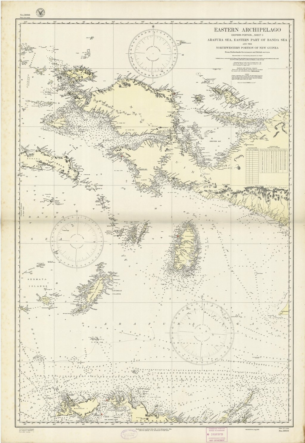
Eastern Archipelago - Eastern portion-sheet II- Arafura Sea, Eastern part of Banda Sea and the Northwestern portion of New Guinea From Netherlands Government and British surveys. Harbor and special charts - there are special charts of those places of which the names are underlined thus: Egeron Strait. Washington, D.C., published May, 1924, at the Hydrographic Office, under the authority of the Secretary of the navy. Small corrections Printed. Editorially folded. Autore: Admiralty Charts. Luogo: Sud Pacifico. Anno: '900. Dimensioni: 661x652 mm
Anno di pubblicazione: '900
