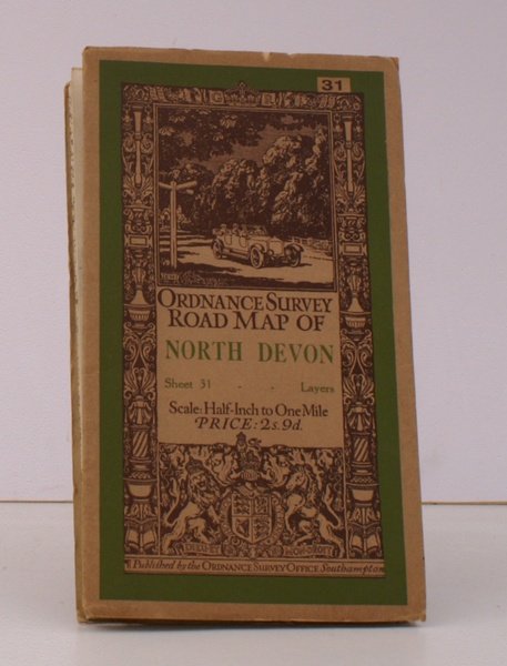
Ordnance Survey Road Map of North Devon. Sheet 31. Layers. Scale: Half-Inch to One Mile NEAR FINE COPY
Ordnance Survey Road Map of North Devon. Sheet 31. Layers. Scale: Half-Inch to One Mile NEAR FINE COPY | Libri antichi e moderni | Ordnance Survey
Libri antichi e moderni
Ordnance Survey
Ordnance Survey, Southampton,
1919
23,00 €
(Devon,
Regno Unito)
Metodi di Pagamento
- PayPal
- Carta di Credito
- Bonifico Bancario
- Pubblica amministrazione
- Carta del Docente
Dettagli
- Anno di pubblicazione
- 1919
- Autore
- Ordnance Survey
- Editori
- Ordnance Survey, Southampton
- Soggetto
- topography, cartography, maps, ordnance survey, ellis martin, devonshire, devon, north devon
- Lingue
- Inglese
Descrizione
Folding coloured map on cloth measuring 32 x 29 ins (approx. 81.25 x 73.6 cms) folding in 21 panels to 7.5 x 4.5 ins (approx. 19.05 x 10.75 cms); original pictorial card wrappers, a remarkably well-preserved, bright, near fine copy. Superb example of Ellis Martin's famous 'car with signpost' cover. This is the green and brown variant used for district maps in 1919. Revised issue of a map first published in 1915. Browne 12.2a.
