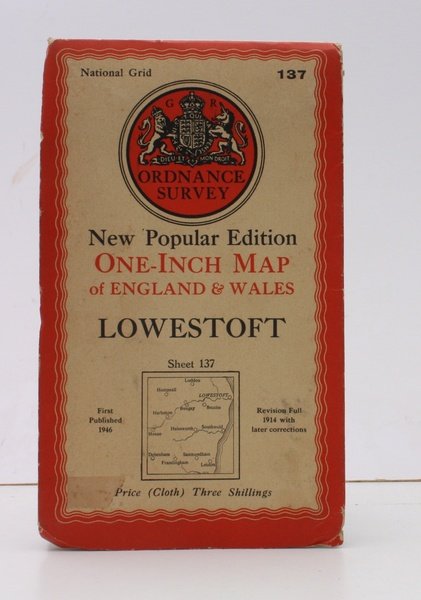
Ordnance Survey One-Inch Map of Lowestoft. New Popular Edition. Sheet 137. Scale: One Inch to to One Mile. [First Issue thus]. BRIGHT, CLEAN COPY
Ordnance Survey One-Inch Map of Lowestoft. New Popular Edition. Sheet 137. Scale: One Inch to to One Mile. [First Issue thus]. BRIGHT, CLEAN COPY | Libri antichi e moderni | Ordnance Survey
Libri antichi e moderni
Ordnance Survey
Ordnance Survey, Southampton,
1946
18,40 €
(Devon,
Regno Unito)
Metodi di Pagamento
- PayPal
- Carta di Credito
- Bonifico Bancario
- Pubblica amministrazione
- Carta del Docente
Dettagli
- Anno di pubblicazione
- 1946
- Autore
- Ordnance Survey
- Editori
- Ordnance Survey, Southampton
- Soggetto
- topography, cartography, maps, ordnance survey, lowestoft, bungay, saxmundham, ellis martin
- Lingue
- Inglese
Descrizione
Folding coloured map on cloth measuring 30 x 27 ins (approx. 76 x 69 cms) folding in 24 panels to 8.25 x 5.0 ins (approx. 21 x 13 cms); original pictorial card wrappers, a very good, bright, clean copy. The famous New Popular Edition One Inch series began publication in 1940 with evolving typographical cover artwork by Ellis Martin which became the first post-war standard design. This is the 1946 issue with Red Border/Royal Arms/letterpress. Browne 96.1.a.2.
