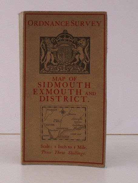
Ordnance Survey Map of Sidmouth, Exmouth and District. Scale: One Inch to to One Mile. NEAR FINE COPY
Ordnance Survey Map of Sidmouth, Exmouth and District. Scale: One Inch to to One Mile. NEAR FINE COPY | Libri antichi e moderni | Ordnance Survey
Libri antichi e moderni
Ordnance Survey
Ordnance Survey, Southampton,
1927
25,30 €
(Devon,
Regno Unito)
Metodi di Pagamento
- PayPal
- Carta di Credito
- Bonifico Bancario
- Pubblica amministrazione
- Carta del Docente
Dettagli
- Anno di pubblicazione
- 1927
- Autore
- Ordnance Survey
- Editori
- Ordnance Survey, Southampton
- Soggetto
- topography, cartography, maps, ordnance survey, sidmouth, exmouth
- Lingue
- Inglese
Descrizione
Folding coloured map on cloth measuring 21 x 30 ins (approx. 53.3 x 76.2 cms) folding in 24 panels to 7.0 x 4.0 ins (approx. 17.7 x 10.1 cms); original pictorial card wrappers, a remarkably well-preserved, bright, near fine copy. Bright, crisp example of the 'Official' Royal Arms cover. This variant is single lineation on buff/black arms with red/location map used for the One Inch Popular Edition c.1927. Revised issue of a map issued in third revision 1912-14 with minor corrections 1923-6. Browne 8.1.a.1.
