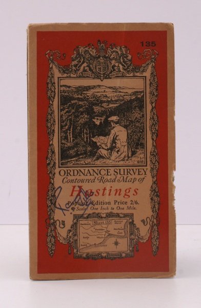
Ordnance Survey Contoured Road Map of Hastings. Popular Edition. One Inch. Sheet 135. [Ellis Martin cover].
Ordnance Survey Contoured Road Map of Hastings. Popular Edition. One Inch. Sheet 135. [Ellis Martin cover]. | Libri antichi e moderni | Ordnance Survey
Libri antichi e moderni
Ordnance Survey
Ordnance Survey, [Southampton,
1933
18,40 €
(Devon,
Regno Unito)
Metodi di Pagamento
- PayPal
- Carta di Credito
- Bonifico Bancario
- Pubblica amministrazione
- Carta del Docente
Dettagli
- Anno di pubblicazione
- 1933
- Autore
- Ordnance Survey
- Editori
- Ordnance Survey, [Southampton
- Soggetto
- topography, hastings, os, ordnance survey, maps, ordnance survey, topography, maps, ordnance, survey, contoured, road, map, hastings
- Lingue
- Inglese
Descrizione
Folding coloured map on cloth measuring 22.0 x 28.5 ins (approx. 56.0 x 72.0 cms) folding in 21 panels to 7.5 x 4.25 ins (approx. 19.0 x 11.0 cms), small neat contemporary signature on front wrapper else a very good, bright, clean copy. The famous Popular Edition One Inch series was first published in 1919 with striking 'hiker' artwork by Ellis Martin. The present copy is the 1933 revision (roads and railways) of the 1921 impression; the covers are the dark red and black variant with location map. Browne, 11.2.a
