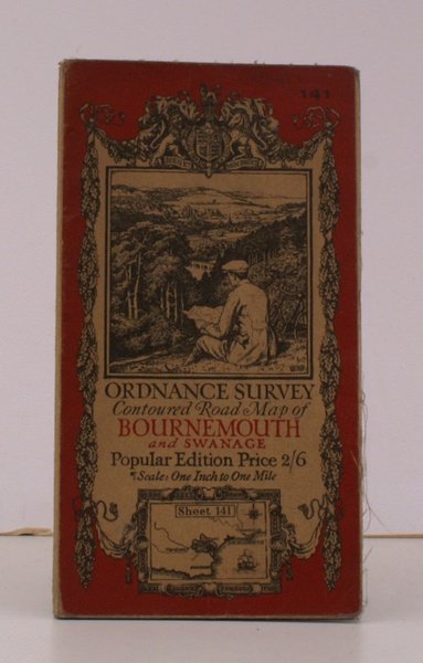
Ordnance Survey Contoured Road Map of Bournemouth and Swanage. Sheet 141. Scale: One Inch to to One Mile. BRIGHT, CLEAN COPY
Ordnance Survey Contoured Road Map of Bournemouth and Swanage. Sheet 141. Scale: One Inch to to One Mile. BRIGHT, CLEAN COPY | Libri antichi e moderni | Ordnance Survey
Libri antichi e moderni
Ordnance Survey
Ordnance Survey, Southampton,
1926
23,00 €
(Devon,
Regno Unito)
Metodi di Pagamento
- PayPal
- Carta di Credito
- Bonifico Bancario
- Pubblica amministrazione
- Carta del Docente
Dettagli
- Anno di pubblicazione
- 1926
- Autore
- Ordnance Survey
- Editori
- Ordnance Survey, Southampton
- Soggetto
- topography, cartography, maps, ordnance survey, bournemouth, swanage, ellis martin
- Lingue
- Inglese
Descrizione
Folding coloured map on cloth measuring 21 x 30 ins (approx. 53.3 x 76.2 cms) folding in 24 panels to 7.0 x 4.0 ins (approx. 17.7 x 10.1 cms); original pictorial card wrappers, a remarkably well-preserved, bright, near fine copy. The famous Popular Edition One Inch series with striking 'cyclist' artwork by Ellis Martin was first issued in 1919. This is the 1926 revision. The covers are black with red sheet name and location map. Browne, 11.1.a
